“No matter the purity of Paris in France, no matter the beauty of our country’s vistas, no matter how bustling Tokyo may be, how can I forget it among them! Ah, my hometown’s views: Bandaisan in the east, [Iidesan] in the northwest enfolded in snow. Soaring sublimely through town, the pure waters of the Shikimi River flow…“
Kitakata native Ikarashi Osamu, writing in 1908
Humans make geopolitical boundaries. They set down with pen and paper that which then becomes an imagined reality, existing on top of our physical world. Some borders follow geographic features like rivers, but more often, they’re arbitrarily drawn. And consequently, they are rarely neat.
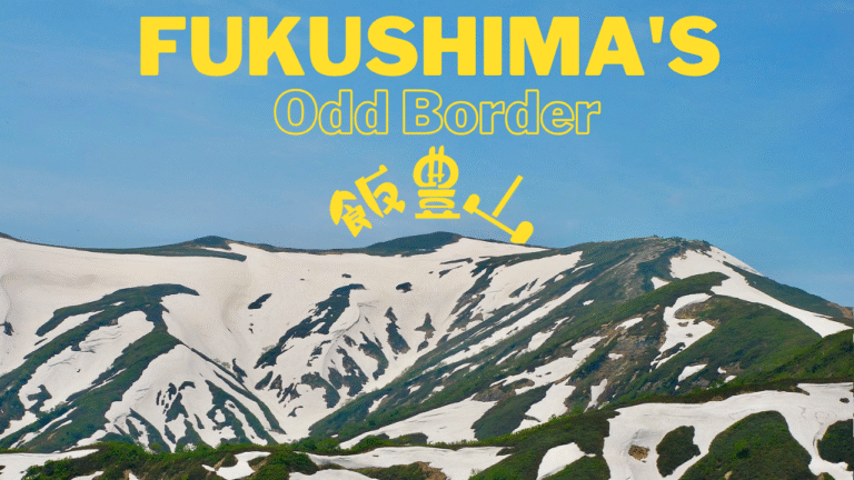
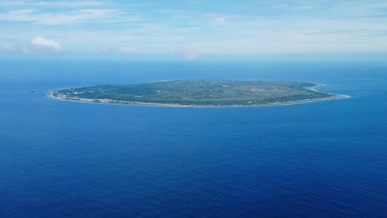
Even those borders that are seemingly “straight” lines have messy histories. The process that created the borders of modern Japanese prefectures has a similarly complex history. And in the Tohoku region, perhaps the strangest border is the tri-point between western Fukushima, southern Yamagata, and northern Niigata Prefectures. Its salient now belongs to Kitakata, a city most famous for its local variety of ramen. While Japan’s prefectures took their earliest form in 1871, the Iidesan tri-point now found in Kitakata was the object of a decades-long campaign. As a result, Fukushima’s modern form only dates to 1908.
This is a story of gods, mountains, wars, and lines in the proverbial sand. Why does Iidesan, along such an odd border, belong to Fukushima?
Between Prefectures, Regions, and Heaven and Earth
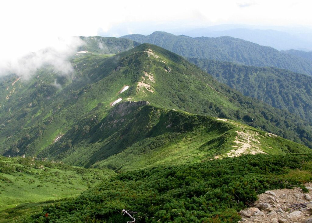
Iidesan — Mount Iide– is a block mountain. It’s mostly granite, but partly slate. Iidesan is the chief peak of the multi-peak Iide mountain range, in turn part of the Ōu Mountains. The range’s peaks vary from 1631 to 2128 meters; Iidesan itself is 2105 meters tall. With such rugged terrain, located as it is in what for many years was on the periphery of the empire nominally ruled from Kyoto, “inside but outside,” it is perhaps unsurprising that Iidesan was a holy mountain and the site of ascetic pilgrimage. Many similarly rugged places in the Ōu Mountains have been the focus of religious journeys. In a recent article, I covered the Dewa Sanzan, three mountains not far from Iidesan. Until the modern era, as with many other such sites of ascetic practice, women were prohibited from climbing the mountain.
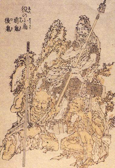
There are different views as to who founded the mountain as an ascetic site. One has it that the legendary En no Ozunu, better known as En no Gyōja, founded it together with a monk from Tang China named Zhidao (Chidō-oshō in Japanese) in 652 CE (Hakuchi 3). By 1595 CE, it had already gone through several periods of prosperity and decline. That year, Gamō Ujisato, then the local daimyo ruling from nearby Kurokawa (later Aizu-Wakamatsu) Castle, ordered the reestablishment of the mountain as a pilgrimage site. Yūmyō, priest of nearby Renge-dera temple, took up the lord’s call. Iidesan has been open to pilgrims ever since, with a shrine at Iidesan’s peak.
Two Shrines As One
While it was once a syncretic Shinto-Buddhist shrine, today, the shrine on the peak is the inner shrine (oku no miya 奥の宮) of Iidesan-jinja. The lower shrine (fumoto no miya 麓宮) is in the valley below. It’s in what used to be Yamato, town but since 2006 has been part of Kitakata City. This two-part division of Iidesan-jinja would go on to prove central to the dispute that gave the Iidesan tri-point its twisting, narrow shape. In order to understand why it was taken away from Fukushima Prefecture to begin with, we need to backtrack to the Edo period.
The Fukushima salient that runs along Iidesan’s peak was historically part of Higashi-Kanbara County. This was one of the counties in Echigo Province. Today, most of it is still part of Niigata Prefecture. For most of the Edo period, Aizu domain controlled this county. Aizu, centered in the southwest of neighboring Mutsu Province, had its capital in what today is Aizuwakamatsu City. It was ruled by one of the Tokugawa shogun’s cousins. The shogun entrusted the Aizu daimyo with more than simply the administration of the daimyo’s own core territory. Together with the Shogunal territory in Minamiyama (mostly made up of modern Fukushima Prefecture’s Minami-Aizu County), it also administered Higashi-Kanbara County in Echigo.
While the inner shrine of Iidesan-jinja is in Higashi-Kanbara County, the lower shrine is in modern Kitakata City, in the former Ichinoki Village, which was in Mutsu Province’s Yama County. But for the entirety of its existence, this division mattered little, as both sides of the county and province line were under the rule of whoever controlled Aizu-Wakamatsu. But in 1868, all that changed.
War and Reorganization
At the end of the Boshin War, Aizu domain was broken and its ruling family, the Matsudaira, was uprooted and dispossessed along with its band of retainers. The Matsudaira family had run afoul of the victorious Satsuma-Chōshū alliance due to its political activities in Kyoto in 1868, and of all the Tohoku fiefs, Aizu was singled out for the most severe punishment. In the war’s wake, the core of the old Aizu domain became Wakamatsu Prefecture, administered by an imperial governor. Wakamatsu Prefecture merged into the extant Fukushima Prefecture in 1876, creating today’s iteration of the prefecture. Today, Fukushima is still divided broadly into three major regions: Hama-dōri on the coast, Naka-dōri slightly inland, and beyond the mountains and large Lake Inawashiro, Aizu furthest west.
Wakamatsu Prefecture– the defeated Aizu– was attached to Fukushima just 8 years after the domain’s bloody demise. To have it as part of Fukushima was highly inconveniencing for Aizu people. This was because they would have to go over the mountains to get to the prefectural capital at Fukushima City. It should come as no surprise, then, that in 1881, some people in the former Wakamatsu territory began to agitate for the capital’s relocation. Setting up a new capital at Kōriyama, significantly closer, would be far more equitable for the prefecture. Even the Fukushima prefectural assembly agreed in 1885, and forwarded the decision to the Home Ministry (what today would be the Ministry of Internal Affairs and Communications). But rather than greenlighting the plan, the ministry forbade it. Simultaneously, some in Aizu also favored the reestablishment of the disestablished Wakamatsu Prefecture; this too was forbidden despite many petitions.
What the imperial government did instead, on May 25, 1886, was to split off Higashi-Kanbara County from Fukushima Prefecture and reassign it to Niigata. It’d been part of the old Echigo Province in the first place, and nearly all of Echigo had become Niigata Prefecture. Reassigning it also shrunk Fukushima’s size, and made both the arguments for prefectural independence of Aizu as well as the request to move the capital to Kōriyama a moot point.
Unfortunately, this also severed Iidesan and the shrine at its peak from Fukushima. And to their credit, despite all the war and upheaval they’d faced which could’ve understandably worn them down, the villagers of Ichinoki, cut off from the other half of their most important shrine, spoke out.
Decades of Protest
The Ichinoki villagers insisted that although there were two buildings– one in the village and one on the mountaintop– they were one shrine together. The central government dithered for years– did the shrine on Iidesan belong to Ichinoki village in Fukushima, or Sanekawa village, now in Niigata?
These protests and petitions continued for over two decades.
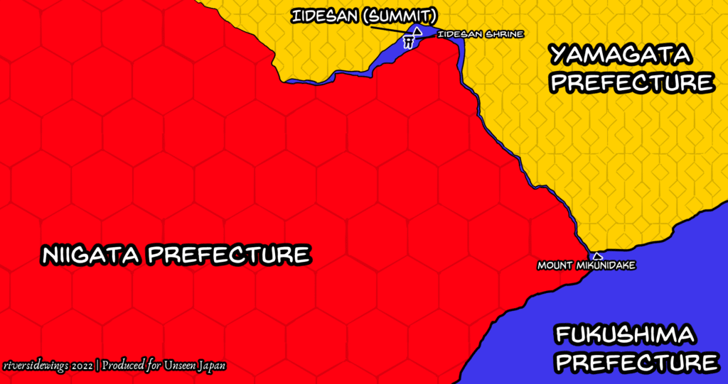
At long last, in 1908, the Home Ministry hit upon a compromise. While Higashi-Kanbara would remain part of Niigata Prefecture, the prefectural boundary would be redrawn along Iidesan’s ridgeline. After Mount Mikunidake, Fukushima’s territory narrows to the point that at times you can even stand with one foot in Niigata and one foot in Yamagata and be straddling Fukushima! Eventually, this opens around Iidesan’s summit, where surrounded by a protective mound of stones behind a roughly hewn wooden torii, stands Iidesan-jinja’s inner shrine.
Iidesan Today
Today, Iidesan is famous not only for the strangeness of its border. It is also an attractive location for hiking. Rather notably, 20th-century mountaineer Fukada Kyūya listed Iidesan in his influential 1964 book Nihon Hyaku-meizan (One Hundred Mountains of Japan), which drove further interest in it. Two major cabins for hikers stand on the peak, one of them almost overshadowing the inner shrine. The shrine remains active.
The unobstructed view from that high altitude remains spectacular. And although the border is not clearly marked on the ground itself, it remains a part of Fukushima Prefecture – and a connection to the Aizu past.
Keep reading
Sources
- Carmen Blacker. The Catalpa Bow: A Study of Shamanistic Practices in Japan. (Surrey: Taylor & Francis, 2005), p. 101.
- “Fukushima-ken Gikai Shuyō Nenpyō (Meiji 1-24)” “福島県議会主要年表(明治元年~24年)”. Fukushima Prefecture Assembly 福島県議会, published November 24, 2015. Accessed 19 January 2022.
- Fukushima-ken Yama-gun shi 福島県耶麻郡誌. (Tokyo: Keigansha, Taisho 8 [1919]), p. 312.
- “Iidesan Jinja.” Yaokami.jp, retrieved 17 January 2022.
- “Iidesan no Rekishi” 飯豊山の歴史. Kitakata Kankō. Retrieved 16 January 2022.
- Ikarashi Osamu. “Waga Furusato.” Romaji, Vol. IV No. 2, November 25, 1908, p. 9.
- Takao Kikuchi. “The Vegetation of Mount Iide, as Representative of Mountains with Heavy Snowfall in Japan.” Mountain Research and Development Vol. 1, No. 3/4 (Dec., 1981), pp. 261-265
- Wes Lang. “Mt. Iide.” Hiking in Japan. Retrieved 20 January 2022.
- ____. “Hyakumeizan.” Hiking in Japan. Retrieved 20 January 2022.
- Noguchi Shinichi 野口信一. Aizu-han 会津藩. (Tokyo: Gendai Shokan, 2005), p. 42.
- Ōuchi Masato 大内雅人, “Fukushima-keniki no seiritsu to Aizuwakamatsu Bunken Mondai” 福島県域の成立と会津若松分県問題. Gakushūin Shigaku 学習院史学 41: 70-83, pp. 70-76.
- Takahashi Tomio 高橋富雄. Hiraizumi: Ōshū Fujiwara-shi Yondai 平泉:奥州藤原氏四代 (Tokyo: Kyōikusha, 1978), p. 28.
- “Yamato-chō no Shōkai” 山都町の紹介 Kitakata City. Retrieved 20 January 2022.
- “Yamato Soba no Rutsu to wa” 山都そばのルーツとは, p. 8 of Graph Utsukushima: Fukushima-ken Jōhō-shi No. 26 (Autumn 2004) グラフうつくしま : 福島県情報誌. (秋) (26) (Fukushima: Fukushima-ken Kensei Gurūpu, 2004).